Python數據獲取實現圖片數據提取
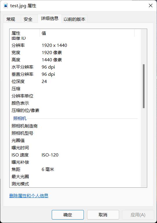
比如我隨便從手機上傳一張圖片到我的電腦裡,通過python可以獲取這張照片的所有信息。如果是數碼相機拍攝的照片,我們在屬性裡可以找到照片拍攝的時間,拍攝的經緯度,海拔高度。
那麼這些信息有什麼作用呢?
有很多功能…比如用戶畫像,客戶信息標簽設定等等,用戶喜歡拍攝照片的季節,時間點,所使用的相機的參數指標可以反應出一個人的金錢狀況,對於其拍攝的內容,我們可以通過AI的方式對照片的內容信息進行提取,從而判斷一個人的興趣愛好。
一、利用exifread提取圖片的EXIF信息
exifread介紹:
EXIF信息,是可交換圖像文件的縮寫,是專門為數碼相機的照片設定的,可以記錄數碼照片的屬性信息和拍攝數據。EXIF可以附加於JPEG、TIFF、RIFF等文件之中,為其增加有關數碼相機拍攝信息的內容和索引圖或圖像處理軟件的版本信息。
首先要安裝ExifRead:
pip3 install ExifRead
pic=r'D:\S072003Python\input\test\test.jpg'

import exifread
f = open(pic, 'rb')
tags = exifread.process_file(f)
print(tags) #內有相機型號,拍攝時間,經緯度等

tags
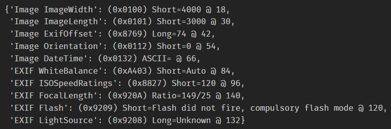
print(tags)和tags獲取數據的格式不同。
tags['Image ImageWidth']
tags['Image ImageLength']
tags['Image ExifOffset']
tags['Image Orientation']
tags['Image DateTime']
tags['EXIF WhiteBalance']
tags['EXIF ISOSpeedRatings']
tags['EXIF FocalLength']
tags['EXIF Flash']
tags['EXIF LightSource']
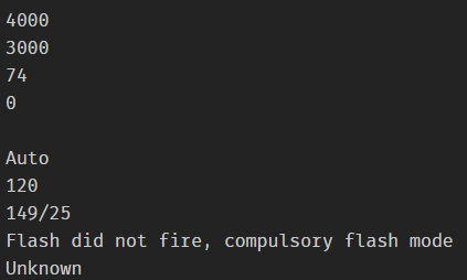
exifcolumns=['Image ImageWidth','Image ImageLength','Image ExifOffset','Image Orientation','Image DateTime','EXIF WhiteBalance','EXIF ISOSpeedRatings','EXIF FocalLength','EXIF Flash','EXIF LightSource'] # 把要提取的數據都封裝在列表當中
for i in range(len(exifcolumns)):
    print(tags[exifcolumns[i]]) # 使用循環拿到所有的數據
二、循環遍歷圖片信息
任務:一次性獲得以下圖片的"Image ImageWidth"信息。寫一個循環即可:
import exifread
import os
import pandas as pd
import glob
pic_list=glob.glob(r'C:\Users\Lenovo\Pictures\Saved Pictures\*.jpg')  # 如果是png,jpeg,bmp等數據格式,如何設置?

for i in pic_list:
    fr=open(i,'rb')
    tags=exifread.process_file(fr)
    if "Image ImageWidth" in tags:  # 條件判斷,因為並不是所有的照片都有"Image ImageWidth"
        print(tags["Image ImageWidth"])
# 經緯度獲取
import exifread
import os
import pandas as pd
import glob
pic_list=glob.glob(r'C:\Users\Lenovo\Pictures\Saved Pictures\*.jpg')

latlonlists=[]
for i in pic_list:
    fr=open(i,'rb')
    tags=exifread.process_file(fr)
    if "GPS GPSLatitude" in tags:  # 條件判斷,因為並不是所有的照片都有"Image ImageWidth"
        # 維度轉換
        lat_ref=tags["GPS GPSLatitudeRef"]
        lat=tags["GPS GPSLatitude"].printable[1:-1].replace(" ","").replace("/",",").split(",")
        lat=float(lat[0])+float(lat[1])/60+float(lat[2])/3600
        if lat_ref  in  ["N"]:    # 表示是南半球的數據
            lat=lat*(-1)
        # 經度轉換
        lon_ref=tags["GPS GPSLongitudeRef"]
        lon=tags["GPS GPSLongitude"].printable[1:-1].replace("","").replace("/",",").split(",")
        lon=float(lon[0])+float(lon[1])/60+float(lon[2])/3600
        if lon_ref  in  ["E"]:    # 表示是西半球的數據
            lon=lon*(-1)

        print("維度:",lat,"經度:",lon)
        latlonlist=[lat,lon]
        latlonlists.append(latlonlist)
到此這篇關於Python數據獲取實現圖片數據提取的文章就介紹到這瞭,更多相關Python 圖片數據提取內容請搜索WalkonNet以前的文章或繼續瀏覽下面的相關文章希望大傢以後多多支持WalkonNet!
推薦閱讀:
- python解析照片拍攝時間進行圖片整理
- Python實現獲取照片的地理定位信息
- 如何用python獲取到照片拍攝時的詳細位置(附源碼)
- python利用文件時間批量重命名照片和視頻
- 利用Python實現獲取照片位置信息