VUE + OPENLAYERS實現實時定位功能
前言
本系列文章介紹一個簡單的實時定位示例,示例的組成主要包括:
- 服務後端,使用 Java 語言編寫,模擬生成 GeoJSON 數據。
- 前端展示,使用 Vue + OpenLayers ,負責定時向後端服務請求 GeoJSON 數據,並在以標簽的形式展現定位數據。
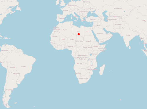
實現的效果:
一、定義標簽樣式
	var image = new CircleStyle({
	  radius: 5,
	  fill: new Fill({
	    color: "rgba(255, 0, 0, 1)"
	  }),
	  stroke: new Stroke({ color: "red", width: 1 })
	});

	var styles = {
	  Point: new Style({
	    image: image
	  })
	};

	var styleFunction = function(feature) {
	  return styles[feature.getGeometry().getType()];
	};
二、模擬 GeoJSON 數據
	var geojsonObject = {
	  type: "FeatureCollection",
	  features: [
	    {
	      type: "Feature",
	      geometry: {
	        type: "Point",
	        coordinates: [0, 0]
	      }
	    }
	    //此處可以添加更多 feature
	  ]
	};
三、創建 VerctorLayer
	//讀取 GeoJSON, 將其作為 vectorSource 的數據源
	var vectorSource = new VectorSource({
	  features: new GeoJSON().readFeatures(geojsonObject)
	});

	var vectorLayer = new VectorLayer({
	  source: vectorSource,
	  style: styleFunction
	});
四、構建地圖
      mounted() {
    this.map = new Map({
      layers: [
        new TileLayer({
          source: new OSM()
        }),
        vectorLayer
      ],
      target: "map",
      view: new View({
        center: [0, 0],
        zoom: 2
      })
    });

	//設置定時任務,調用移動標簽方法
    setInterval(this.translate, 500);
  },
五、模擬實時移動
	 methods: {
	    translate() {
	      //遍歷標簽, 修改坐標位置
	      vectorSource.forEachFeature(function(f) {
	        console.log("translate");

	        //隨機產生坐標增量(此處不是坐標絕對值!!!!)
	        var x = Math.random() * 1000000;
	        var y = Math.random() * 1000000;
	        f.getGeometry().translate(x, y);
	      });
	    }
	  }
總結
以上是一個簡單實時定位前端示例,通過模擬的 GeoJSON 對象展示標簽,並通過定時任務模擬標簽位置變化。下一篇將使用 Java 服務端提供位置數據,完整模擬一個實時定位系統。
可以在vue項目中直接運行的完整代碼:
	<template>
	  <div>
	    <span>hi, map</span>
	    <div id="map" class="map"></div>
	  </div>
	</template>

	<script lang="ts">
	import "ol/ol.css";
	import GeoJSON from "ol/format/GeoJSON";
	import Map from "ol/Map";
	import View from "ol/View";
	import { Circle as CircleStyle, Fill, Stroke, Style } from "ol/style";
	import { OSM, Vector as VectorSource } from "ol/source";
	import { Tile as TileLayer, Vector as VectorLayer } from "ol/layer";

	import Vue from "vue";

	var image = new CircleStyle({
	  radius: 5,
	  fill: new Fill({
	    color: "rgba(255, 0, 0, 1)"
	  }),
	  stroke: new Stroke({ color: "red", width: 1 })
	});

	var styles = {
	  Point: new Style({
	    image: image
	  })
	};

	var styleFunction = function(feature) {
	  return styles[feature.getGeometry().getType()];
	};

	var geojsonObject = {
	  type: "FeatureCollection",
	  features: [
	    {
	      type: "Feature",
	      geometry: {
	        type: "Point",
	        coordinates: [0, 0]
	      }
	    }
	  ]
	};

	var vectorSource = new VectorSource({
	  features: new GeoJSON().readFeatures(geojsonObject)
	});

	var vectorLayer = new VectorLayer({
	  source: vectorSource,
	  style: styleFunction
	});

	export default Vue.extend({
	  data() {
	    return {
	      map: {}
	    };
	  },
	  mounted() {
	    this.map = new Map({
	      layers: [
	        new TileLayer({
	          source: new OSM()
	        }),
	        vectorLayer
	      ],
	      target: "map",
	      view: new View({
	        center: [0, 0],
	        zoom: 2
	      })
	    });

	    setInterval(this.translate, 500);
	  },

	  methods: {
	    translate() {
	      vectorSource.forEachFeature(function(f) {
	        console.log("translate");
	        var x = Math.random() * 1000000;
	        var y = Math.random() * 1000000;
	        f.getGeometry().translate(x, y);
	      });
	    }
	  }
	});
	</script>
	<style>
	.map {
	  width: 100%;
	  height: 600px;
	}
	</style>
到此這篇關於VUE + OPENLAYERS實現實時定位功能的文章就介紹到這瞭,更多相關VUE OPENLAYERS 定位內容請搜索WalkonNet以前的文章或繼續瀏覽下面的相關文章希望大傢以後多多支持WalkonNet!
推薦閱讀:
- Vue+penlayers實現多邊形繪制及展示
- vue項目中openlayers繪制行政區劃
- 基於Vue+Openlayer實現動態加載geojson的方法
- Vue+Openlayer中使用select選擇要素的實現代碼
- Vue+Openlayer批量設置閃爍點的實現代碼(基於postrender機制)