vue項目中openlayers繪制行政區劃
vue項目中openlayers畫行政區劃(區域范圍),供大傢參考,具體內容如下
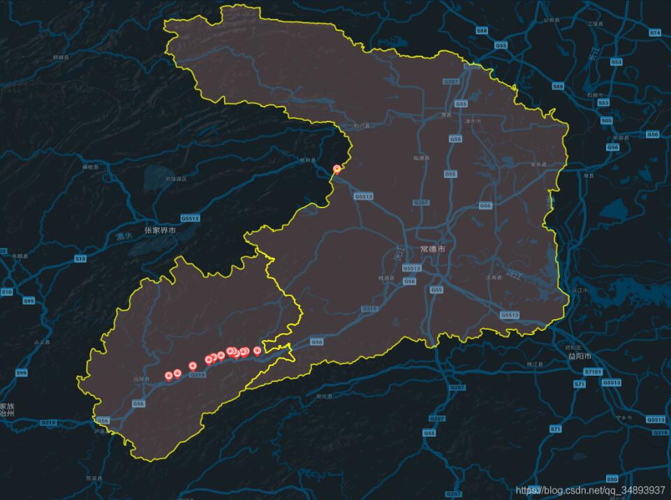
原理
在地圖上畫需要的范圍,實際上就是在地圖上打上一圈點,然後依次將這些點用線連接,就形成瞭范圍
引用相應的ol模塊
import VectorLayer from 'ol/layer/Vector'
import VectorSource from 'ol/source/Vector'
import { Map, View, Feature } from 'ol'
import { Style, Icon, Stroke } from 'ol/style'
import { Point, LineString, Polygon } from 'ol/geom'
獲取范圍點
這裡我將點放在json文件中,然後通過axios讀取
json文件截圖:

axios.get('static/常德市.json').then((res) => {
 let arr = res.data.coordinates
 let polygonFeature = new Feature({
   type: 'polygon',
   geometry: new Polygon(arr[0])
  })
  polygonFeature.setStyle(new Style({
   stroke: new Stroke({
   width: 2,

   color: [255, 255, 0, 0.8]
   }),
   fill: new Fill({
   color: [248, 172, 166, 0.2]
   })
   // text: new Text({
   // text: '這是區域'
   // })
  }))
  let polygonLayer = new VectorLayer({
   source: new VectorSource({
   features: [polygonFeature]
   })
  })
  this.gmap.addLayer(polygonLayer)
  })
  axios.get('static/懷化市沅陵縣.json').then((res) => {
  let arr = res.data.coordinates
  let polygonFeature = new Feature({
   type: 'polygon',
   geometry: new Polygon(arr[0])
  })
  polygonFeature.setStyle(new Style({
   stroke: new Stroke({
   width: 2,
   color: [255, 255, 0, 0.8]
   }),
   fill: new Fill({
   color: [248, 172, 166, 0.2]
   })
   // text: new Text({
   // text: '這是區域'
   // })
  }))
  let polygonLayer = new VectorLayer({
   source: new VectorSource({
   features: [polygonFeature]
   })
  })
  this.gmap.addLayer(polygonLayer)
  })
以上就是本文的全部內容,希望對大傢的學習有所幫助,也希望大傢多多支持WalkonNet。
推薦閱讀:
- 基於Vue+Openlayer實現動態加載geojson的方法
- VUE + OPENLAYERS實現實時定位功能
- Vue+Openlayer批量設置閃爍點的實現代碼(基於postrender機制)
- Vue+penlayers實現多邊形繪制及展示
- Vue+Openlayer實現圖形的拖動和旋轉變形效果